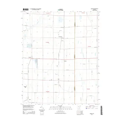
2014 Map of Amagon
USGS Topo · Published 2014About this map
The Cache River meanders through this agricultural section of the Arkansas Delta, defining the western edge of a landscape crisscrossed by county roads and drainage systems like Threemile Creek and Mink Slough. Several small communities and named junctions populate the grid, including Amagon, Algoa, and Balch, reflecting the rural settlement patterns of Jackson County. This 2014 survey serves as a vital tool for genealogists, as it meticulously identifies numerous family and community burial grounds scattered across the acreage. Researchers can find the Johnson Cem, Martin Cem, Jackson Cem, Carter Cem, and the uniquely named 'Bill' Ford Cem. The transition from the river bottomlands to the managed fields is further evidenced by landmarks such as Griddle Lake and Brewer Lake, while the eastern border is marked by the Jackson Co Poinsett Co line.
Find a feature on this map
43 named features on this map. Tap any name to fly to it.
Don’t see what you’re looking for? This feature index may not catch every label — zoom into the map to look around manually.
Map Details
Editions of this 2014 Amagon Map
This is the sole edition of this map. No revisions or reprints were ever made.
Other maps of this area

1935 · Tuckerman
USGS Topo · 1:62,500

1939 · Vanndale
USGS Topo · 1:62,500

1939 · Weiner
USGS Topo · 1:62,500

1940 · Tilton
USGS Topo · 1:62,500

1953 · Memphis
USGS Topo · 1:250,000

1956 · Memphis
USGS Topo · 1:250,000

1956 · Tilton
USGS Topo · 1:62,500

1958 · Vanndale
USGS Topo · 1:62,500

1959 · Weiner
USGS Topo · 1:62,500

1960 · Weiner
USGS Topo · 1:62,500