2024 Map of Amagon
USGS Topo · Published 2024About this map
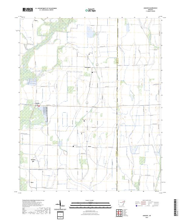
Stringers Mill and several family burial grounds define the landscape of eastern Jackson County, where the agricultural plains meet the protected wetlands of the Cache River National Wildlife Refuge. This modern survey illustrates a network of small settlements including Amagon, Balch, Pennington, and Algoa, many of which are connected by a grid of county roads such as Amagon St and State Hwy 384. The drainage of the region is dominated by the slow-moving waters of the Cache River, along with Threemile Creek and several oxbow remnants like Griddle Lake and Brewer Lake. The distribution of cemeteries like Carter Cem, Ford Cem, and Martin Cem provides a clear view of the historical footprint of rural families in this part of Arkansas. The boundary between Jackson Co and Poinsett Co is clearly marked, following the path of Threemile Creek through the eastern portion of the quadrangle.
Find a feature on this map
76 named features on this map. Tap any name to fly to it.
Don’t see what you’re looking for? This feature index may not catch every label — zoom into the map to look around manually.
Map Details
Editions of this 2024 Amagon Map
This is the sole edition of this map. No revisions or reprints were ever made.