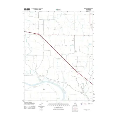
2012 Map of Amazonia
USGS Topo · Published 2012About this map
Amazonia sits near the bend of the Missouri River in this 2012 study of Andrew County, marking a landscape where river bottoms meet upland agriculture. The settlement of Nodaway is positioned north of the wide Burr Oak Bottom, where the Nodaway River joins the Missouri. This area is characterized by a dense network of country roads and numerous small family or community burial grounds, such as Jackson Cemetery, Clizer Cemetery, and Gillispie Cemetery, which provide significant points of interest for those researching local lineage and rural settlement patterns.
Find a feature on this map
76 named features on this map. Tap any name to fly to it.
Don’t see what you’re looking for? This feature index may not catch every label — zoom into the map to look around manually.
Map Details
Editions of this 2012 Amazonia Map
This is the sole edition of this map. No revisions or reprints were ever made.
Other maps of this area

1885 · Atchison
USGS Topo · 1:125,000

1888 · Atchison
USGS Topo · 1:125,000

1893 · Atchison
USGS Topo · 1:125,000

1924 · St. Joseph
USGS Topo · 1:62,500

1926 · Saint Joseph
USGS Topo · 1:62,500

1926 · Oregon
USGS Topo · 1:62,500

1926 · Maitland
USGS Topo · 1:62,500

1927 · Bolckow
USGS Topo · 1:62,500

1945 · Bolckow
USGS Topo · 1:62,500

1950 · Kansas City
USGS Topo · 1:250,000