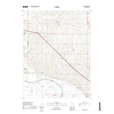
2017 Map of Amazonia
USGS Topo · Published 2017About this map
The Missouri River carves a sharp boundary between Andrew County, Missouri, and Doniphan County, Kansas, as it flows through this river-bottom landscape. The settlement of Amazonia sits on the bluffs overlooking the river's path, while the smaller community of Nodaway is positioned to the northwest near the confluence with the Nodaway River. A prominent Levee line traces the riverbank, protecting the fertile lowlands of Burr Oak Bottom from the unpredictable seasonal waters.
Find a feature on this map
97 named features on this map. Tap any name to fly to it.
Don’t see what you’re looking for? This feature index may not catch every label — zoom into the map to look around manually.
Map Details
Editions of this 2017 Amazonia Map
This is the sole edition of this map. No revisions or reprints were ever made.
Other maps of this area

1885 · Atchison
USGS Topo · 1:125,000

1888 · Atchison
USGS Topo · 1:125,000

1893 · Atchison
USGS Topo · 1:125,000

1924 · St. Joseph
USGS Topo · 1:62,500

1926 · Saint Joseph
USGS Topo · 1:62,500

1926 · Oregon
USGS Topo · 1:62,500

1926 · Maitland
USGS Topo · 1:62,500

1927 · Bolckow
USGS Topo · 1:62,500

1945 · Bolckow
USGS Topo · 1:62,500

1950 · Kansas City
USGS Topo · 1:250,000