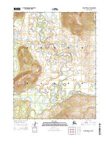
2015 Map of Ambler River A-4 NE
USGS Topo · Published 2015About this map
Ambler River and the Redstone River converge in this northern landscape, creating a complex network of meanders and oxbow lakes typical of the Arctic river systems in the Northwest Arctic region. The terrain is defined by the transition from low-lying riparian wetlands to the rising elevations of the Manullyisat Hills in the southwest corner of the sheet. Surveyed under the Public Land Survey System, the map detail includes the boundaries of t21n r5e, t21n r6e, t20n r5e, and t20n r6e. Smaller waterways like Agnes Cr drain the higher ground to the north, feeding into the larger river valleys that dominate the local topography. This 2015 USGS record provides a precise look at the hydrology of the area before environmental shifts significantly alter these remote western Alaskan drainages.
Find a feature on this map
8 named features on this map. Tap any name to fly to it.
Don’t see what you’re looking for? This feature index may not catch every label — zoom into the map to look around manually.
Map Details
Editions of this 2015 Ambler River A-4 NE Map
This is the sole edition of this map. No revisions or reprints were ever made.
Other maps of this area

1951 · Ambler River
USGS Topo · 1:250,000

1955 · Ambler River A-4
USGS Topo · 1:63,360

1956 · Ambler River
USGS Topo · 1:250,000

1964 · Ambler River
USGS Topo · 1:250,000
1966 · Ambler River A-4
USGS Topo · 1:63,360
1985 · Ambler River A-3
USGS Topo · 1:63,360
1990 · Ambler River B-3
USGS Topo · 1:63,360
1990 · Ambler River B-4
USGS Topo · 1:63,360
2015 · Ambler River B-4 SW
USGS Topo · 1:25,000
2015 · Ambler River B-4 SE
USGS Topo · 1:25,000