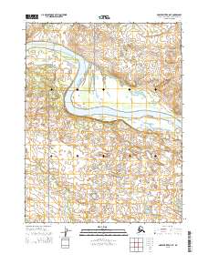
2015 Map of Ambler River A-5 SE
USGS Topo · Published 2015About this map
The Kobuk River carves a massive, serpentine path through this Arctic landscape, defining the character of the Kobuk Valley National Park in the northwest. This 2015 U.S. Geological Survey representation highlights a transition in the river's course, where it shifts from a broad westward flow to a sharp southern bend, creating significant gravel bars and shifting embankments. Smaller drainages like Omaluruk Cr and Nakochelik Cr feed into the main waterway from the south and east, while Jade Cr enters from the north. The map underscores the dominance of the river system over human infrastructure, showing no established roads or settlements, only the intricate topography and the hydrographic network that has shaped this region for millennia.
Find a feature on this map
9 named features on this map. Tap any name to fly to it.
Don’t see what you’re looking for? This feature index may not catch every label — zoom into the map to look around manually.
Map Details
Editions of this 2015 Ambler River A-5 SE Map
This is the sole edition of this map. No revisions or reprints were ever made.
Other maps of this area

1951 · Shungnak
USGS Topo · 1:250,000

1951 · Ambler River
USGS Topo · 1:250,000

1955 · Shungnak
USGS Topo · 1:250,000

1955 · Ambler River A-4
USGS Topo · 1:63,360

1955 · Shungnak D-4
USGS Topo · 1:63,360

1955 · Shungnak D-5
USGS Topo · 1:63,360

1955 · Ambler River A-5
USGS Topo · 1:63,360

1956 · Ambler River
USGS Topo · 1:250,000

1964 · Shungnak
USGS Topo · 1:250,000

1964 · Ambler River
USGS Topo · 1:250,000