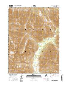
2016 Map of Ambler River B-2 SE
USGS Topo · Published 2016About this map
The Schwatka Mountains dominate this high-latitude terrain within the Northwest Arctic Borough of Alaska. This topographic profile captures the headwaters and high-relief drainage patterns of the Shungnak River, which carves through the central and eastern portions of the sheet. The landscape is defined by its extreme elevation changes and sharp ridgelines, representing a wilderness state essentially devoid of permanent infrastructure, roads, or named settlements in this era. For researchers, the map provides a precise record of the hydrological network and glacial-carved topography that dictates movement through this part of the Brooks Range.
Find a feature on this map
8 named features on this map. Tap any name to fly to it.
Don’t see what you’re looking for? This feature index may not catch every label — zoom into the map to look around manually.
Map Details
Editions of this 2016 Ambler River B-2 SE Map
This is the sole edition of this map. No revisions or reprints were ever made.
Other maps of this area

1951 · Ambler River
USGS Topo · 1:250,000

1956 · Ambler River
USGS Topo · 1:250,000

1964 · Ambler River
USGS Topo · 1:250,000
1985 · Ambler River A-2
USGS Topo · 1:63,360
1985 · Ambler River A-1
USGS Topo · 1:63,360
1990 · Ambler River B-1
USGS Topo · 1:63,360
1990 · Ambler River B-2
USGS Topo · 1:63,360
2016 · Ambler River A-2 NE
USGS Topo · 1:25,000
2016 · Ambler River B-1 NW
USGS Topo · 1:25,000
2016 · Ambler River B-2 SW
USGS Topo · 1:25,000