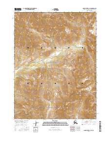
2016 Map of Ambler River C-2 SE
USGS Topo · Published 2016About this map
Gates of the Arctic National Park dominates this northern interior landscape, preserving a vast corridor where the Ambler River winds through the southern reaches of the Schwatka Mountains. The map illustrates a transitional zone where high mountain ridges descend toward the river valley, showing the intricate hydrology of the region's unnamed tributaries feeding into the primary waterway. This 2016 survey captures a portion of the Brooks Range that remains largely untouched by permanent settlements or road infrastructure, defined instead by the topographical complexities of the Northwest Arctic's wilderness. The inclusion of Public Land Survey System township and range boundaries, such as t26n r10e, provides essential reference points for researchers tracking federal land designations and regional wilderness management boundaries within this protected arctic ecosystem.
Find a feature on this map
9 named features on this map. Tap any name to fly to it.
Don’t see what you’re looking for? This feature index may not catch every label — zoom into the map to look around manually.
Map Details
Editions of this 2016 Ambler River C-2 SE Map
This is the sole edition of this map. No revisions or reprints were ever made.
Other maps of this area

1951 · Ambler River
USGS Topo · 1:250,000

1956 · Ambler River
USGS Topo · 1:250,000

1964 · Ambler River
USGS Topo · 1:250,000
1990 · Ambler River C-1
USGS Topo · 1:63,360
1990 · Ambler River B-1
USGS Topo · 1:63,360
1990 · Ambler River B-2
USGS Topo · 1:63,360
1990 · Ambler River C-2
USGS Topo · 1:63,360
2016 · Ambler River C-1 NW
USGS Topo · 1:25,000
2016 · Ambler River C-1 SW
USGS Topo · 1:25,000
2016 · Ambler River B-1 NW
USGS Topo · 1:25,000