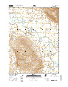
2016 Map of Ambler River D-1 SW
USGS Topo · Published 2016About this map
Gates of the Arctic National Park encompasses the southern portion of this landscape, preserving a vast, undeveloped wilderness in the Alaskan interior. The Noatak River dominates the northern half of the quadrangle, carving a wide, braided course through the terrain and collecting drainage from several significant tributaries. Watercourses like Midas Creek, Ningoyak Cr, and Tunukuchak Cr define the hydrological network, illustrating the complex flow patterns of the Arctic watershed. This 2016 survey documents the region's characteristic topography, where the land rises from the river flats toward higher elevations in the south, reflecting the transition from riparian valleys to the rugged interior mountains within the national park boundaries. The map provides a clear record of the area's natural drainage before further environmental changes or shifts in preservation status.
Find a feature on this map
13 named features on this map. Tap any name to fly to it.
Don’t see what you’re looking for? This feature index may not catch every label — zoom into the map to look around manually.
Map Details
Editions of this 2016 Ambler River D-1 SW Map
This is the sole edition of this map. No revisions or reprints were ever made.
Other maps of this area

1951 · Ambler River
USGS Topo · 1:250,000

1956 · Ambler River
USGS Topo · 1:250,000

1964 · Ambler River
USGS Topo · 1:250,000
1990 · Ambler River C-1
USGS Topo · 1:63,360
1990 · Ambler River D-1
USGS Topo · 1:63,360
1990 · Ambler River D-2
USGS Topo · 1:63,360
1990 · Ambler River C-2
USGS Topo · 1:63,360
2016 · Ambler River C-1 NW
USGS Topo · 1:25,000
2016 · Ambler River D-2 SE
USGS Topo · 1:25,000
2016 · Ambler River C-2 NE
USGS Topo · 1:25,000