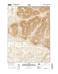
2016 Map of Ambler River D-2 NE
USGS Topo · Published 2016About this map
The vast interior of the Northwest Arctic is defined here by the intersection of two major federal lands: Noatak National Preserve and Gates of the Arctic National Park. This 2016 survey shows the high-elevation terrain where these protected areas meet, dominated by steep contours and the upper reaches of the Arctic drainage system. In the southeastern corner of the map, Douglas Cr flows through the parkland, providing one of the few named landmarks in a region largely devoid of human development or roads. The map illustrates the strictly natural character of the Brooks Range foothills, where the primary identifiers are the Public Land Survey System boundaries such as t30n r10e and t29n r10e, which grid this otherwise trackless wilderness.
Find a feature on this map
7 named features on this map. Tap any name to fly to it.
Don’t see what you’re looking for? This feature index may not catch every label — zoom into the map to look around manually.
Map Details
Editions of this 2016 Ambler River D-2 NE Map
This is the sole edition of this map. No revisions or reprints were ever made.
Other maps of this area

1951 · Howard Pass
USGS Topo · 1:250,000

1951 · Ambler River
USGS Topo · 1:250,000

1956 · Howard Pass
USGS Topo · 1:250,000

1956 · Ambler River
USGS Topo · 1:250,000

1964 · Ambler River
USGS Topo · 1:250,000
1984 · Howard Pass A-2
USGS Topo · 1:63,360
1984 · Howard Pass A-1
USGS Topo · 1:63,360
1990 · Ambler River D-1
USGS Topo · 1:63,360
1990 · Ambler River D-2
USGS Topo · 1:63,360
2016 · Ambler River D-2 SW
USGS Topo · 1:25,000