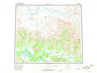
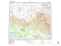
1956 Map of Ambler River
USGS Topo · Published 1970About this map
Onion Portage serves as a critical geographic marker along the Kobuk River, signifying a historic crossing and settlement point in this remote Arctic landscape. The mid-century topography reveals a terrain dominated by the towering Brooks Range, where the Schwatka Mountains and Baird Mountains meet. South of these peaks, the remarkable Great Kobuk Sand Dunes and Little Kobuk Sand Dunes create an unexpected desert-like environment amidst the surrounding tundra and river valleys.
Find a feature on this map
83 named features on this map. Tap any name to fly to it.
Don’t see what you’re looking for? This feature index may not catch every label — zoom into the map to look around manually.
Map Details
Editions of this 1956 Ambler River Map
6 editions found

Other maps of this area

1951 · Baird Mountains
USGS Topo · 1:250,000

1951 · Selawik
USGS Topo · 1:250,000

1951 · Shungnak
USGS Topo · 1:250,000

1951 · Hughes
USGS Topo · 1:250,000

1951 · Survey Pass
USGS Topo · 1:250,000

1951 · Howard Pass
USGS Topo · 1:250,000

1951 · Ambler River
USGS Topo · 1:250,000

1951 · Misheguk Mountain
USGS Topo · 1:250,000

1951 · Killik River
USGS Topo · 1:250,000

1955 · Shungnak
USGS Topo · 1:250,000