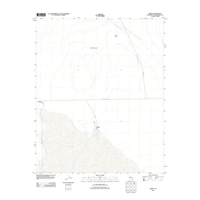
2012 Map of Amboy
USGS Topo · Published 2012About this map
Bristol Lake dominates the southern landscape of this Mojave Desert region, where the vast dry lake bed meets the southern slopes of the Bristol Mountains. This 2012 survey captures the isolation of Amboy and Saltus, two distinct points of human activity along the historic National Trails Hwy. The map reveals how local transit depends on desert arteries like Amboy Rd and Kelbaker Rd, which navigate around drainage features such as Orange Blossom Wash. The settlement at Saltus is particularly notable for its position on the edge of the salt pan, illustrating the specialized industrial or transit-oriented nature of communities in San Bernardino County. From the elevation at Windy Point down to the basin floor, the map details a stark environment defined by its hydrology and historic highway infrastructure.
Find a feature on this map
11 named features on this map. Tap any name to fly to it.
Don’t see what you’re looking for? This feature index may not catch every label — zoom into the map to look around manually.
Map Details
Editions of this 2012 Amboy Map
This is the sole edition of this map. No revisions or reprints were ever made.
Other maps of this area

1942 · Amboy
USGS Topo · 1:250,000

1943 · Amboy
USGS Topo · 1:250,000

1954 · Needles
USGS Topo · 1:250,000

1954 · Bristol Lake NW
USGS Topo · 1:24,000

1954 · Amboy Crater
USGS Topo · 1:24,000

1955 · Lead Mtn. NE
USGS Topo · 1:24,000

1955 · Lead Mountain
USGS Topo · 1:62,500

1956 · Needles
USGS Topo · 1:250,000

1956 · Bristol Lake
USGS Topo · 1:62,500

1956 · Cadiz
USGS Topo · 1:62,500