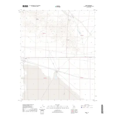
2018 Map of Amboy
USGS Topo · Published 2018About this map
Amboy and Saltus sit at the intersection of a desert rail-and-road corridor, defining the human footprint in this corner of the Mojave Desert. The landscape transition is sharp, moving from the high, relief-rich Bristol Mountains and the prominent Windy Point down into the broad expanse of the Cadiz Valley. Drainage patterns are recorded through features like Orange Blossom Wash, which carves through the northern hills. The map highlights the essential transit arteries of the high desert, including the Amboy Cutoff and Kelbaker Rd, which historically facilitated travel between the interior basins and the mountain passes. This survey serves as a record of these isolated settlements and their relationship to the massive geological formations that surround them.
Find a feature on this map
15 named features on this map. Tap any name to fly to it.
Don’t see what you’re looking for? This feature index may not catch every label — zoom into the map to look around manually.
Map Details
Editions of this 2018 Amboy Map
This is the sole edition of this map. No revisions or reprints were ever made.
Other maps of this area

1942 · Amboy
USGS Topo · 1:250,000

1943 · Amboy
USGS Topo · 1:250,000

1954 · Needles
USGS Topo · 1:250,000

1954 · Bristol Lake NW
USGS Topo · 1:24,000

1954 · Amboy Crater
USGS Topo · 1:24,000

1955 · Lead Mtn. NE
USGS Topo · 1:24,000

1955 · Lead Mountain
USGS Topo · 1:62,500

1956 · Needles
USGS Topo · 1:250,000

1956 · Bristol Lake
USGS Topo · 1:62,500

1956 · Cadiz
USGS Topo · 1:62,500