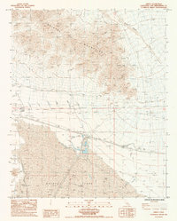
1985 Map of Amboy
USGS Topo · Published 1985About this map
The Bristol Mountains dominate the northern landscape of this Mojave Desert region, giving way to the sprawling dry basin of Bristol Lake in the south. The settlement of Amboy serves as a central hub, situated along the Atchison Topeka and Santa Fe railroad line near a Landing Strip and local Dump. Industrial activity is concentrated around Saltus, where an extensive system of Levee structures and Salt Evaporators marks the commercial extraction of minerals from the lake bed.
Find a feature on this map
23 named features on this map. Tap any name to fly to it.
Don’t see what you’re looking for? This feature index may not catch every label — zoom into the map to look around manually.
Map Details
Editions of this 1985 Amboy Map
This is the sole edition of this map. No revisions or reprints were ever made.
Other maps of this area

1942 · Amboy
USGS Topo · 1:250,000

1943 · Amboy
USGS Topo · 1:250,000

1954 · Needles
USGS Topo · 1:250,000

1954 · Bristol Lake NW
USGS Topo · 1:24,000

1954 · Amboy Crater
USGS Topo · 1:24,000

1955 · Lead Mtn. NE
USGS Topo · 1:24,000

1955 · Lead Mountain
USGS Topo · 1:62,500

1956 · Needles
USGS Topo · 1:250,000

1956 · Bristol Lake
USGS Topo · 1:62,500

1956 · Cadiz
USGS Topo · 1:62,500