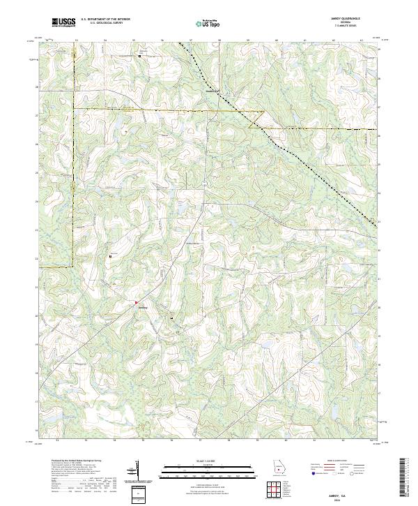
2024 Map of Amboy
USGS Topo · Published 2024About this map
The settlement of Amboy sits at the junction of several rural routes in Turner County, marking a landscape defined by its agricultural roots and complex creek network. This modern survey illustrates the convergence of Crisp, Wilcox, and Turner counties, where family-named landmarks such as Pate Cem and Rainey Cem provide a window into the area's genealogical history. The terrain is deeply carved by water, featuring Double Run Creek, Wolf Creek, and Deep Creek, alongside smaller reservoirs like Gibbs Lake and Tom Halls Pond. The local road network, including Oklahoma Ch Rd and N Railroad St, traces the historical movement of goods and people through the Georgia coastal plain. Further north, the community of Double Run serves as a northern anchor near the Wilcox County line.
Find a feature on this map
82 named features on this map. Tap any name to fly to it.
Don’t see what you’re looking for? This feature index may not catch every label — zoom into the map to look around manually.
Map Details
Editions of this 2024 Amboy Map
This is the sole edition of this map. No revisions or reprints were ever made.
Other maps of this area

1953 · Waycross
USGS Topo · 1:250,000

1958 · Waycross
USGS Topo · 1:250,000

1973 · Irwinville
USGS Topo · 1:24,000

1973 · Ashburn
USGS Topo · 1:24,000

1973 · Bethel
USGS Topo · 1:24,000

1974 · Rebecca
USGS Topo · 1:24,000
1974 · Pitts
USGS Topo · 1:24,000

1974 · Amboy
USGS Topo · 1:24,000
1977 · Arabi
USGS Topo · 1:24,000
1977 · Rochelle
USGS Topo · 1:24,000