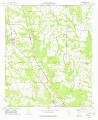
1977 Map of Arabi
USGS Topo · Published 1977About this map
The town of Arabi sits at the intersection of local history and modern transit, centered on the Georgia Southern and Florida railroad. This landscape, straddling the Crisp Co Turner Co line, is defined by small agricultural settlements and a high density of country churches and family cemeteries. To the southeast, small communities like Dakota and Sibley are connected by a network of rural roads and the occasional Jeep Trail.
Find a feature on this map
30 named features on this map. Tap any name to fly to it.
Don’t see what you’re looking for? This feature index may not catch every label — zoom into the map to look around manually.
Map Details
Editions of this 1977 Arabi Map
This is the sole edition of this map. No revisions or reprints were ever made.
Other maps of this area

1953 · Waycross
USGS Topo · 1:250,000

1956 · Sylvester
USGS Topo · 1:62,500

1958 · Waycross
USGS Topo · 1:250,000

1972 · Cuffietown
USGS Topo · 1:24,000

1973 · Ashburn
USGS Topo · 1:24,000

1973 · Bethel
USGS Topo · 1:24,000
1974 · Pitts
USGS Topo · 1:24,000

1974 · Amboy
USGS Topo · 1:24,000
1974 · Cordele
USGS Topo · 1:24,000
1977 · Pateville
USGS Topo · 1:24,000