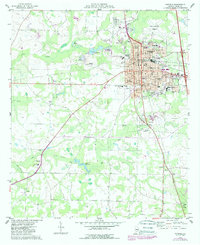
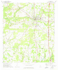
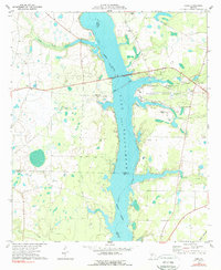
1974 Map of Cordele
USGS Topo · Published 1988About this map
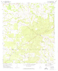
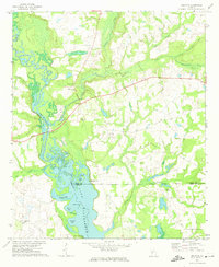
The railroad hub of Cordele serves as the focal point of this mid-1970s survey, showing the city's transition as it expanded near the Crisp Co-Cordele Airport and Pine Hills Country Club. The landscape is a complex network of agriculture and water management, punctuated by numerous small impoundments such as Rays Millpond, Williams Lake, and Burds Millpond. The presence of the Cordele Fish Hatchery and the County Prison Farm south of the city reflect the diverse land use of Crisp County during this era.
Find a feature on this map
47 named features on this map. Tap any name to fly to it.
Don’t see what you’re looking for? This feature index may not catch every label — zoom into the map to look around manually.
Map Details
Editions of this 1974 Cordele Map
This is the sole edition of this map. No revisions or reprints were ever made.
Other maps of this area

1953 · Waycross
USGS Topo · 1:250,000

1957 · Macon
USGS Topo · 1:250,000

1958 · Macon
USGS Topo · 1:250,000

1958 · Waycross
USGS Topo · 1:250,000

1964 · Macon
USGS Topo · 1:250,000
1971 · Pineview SW
USGS Topo · 1:24,000
1972 · Drayton
USGS Topo · 1:24,000
1972 · Vienna
USGS Topo · 1:24,000
1977 · Cobb
USGS Topo · 1:24,000
1977 · Arabi
USGS Topo · 1:24,000