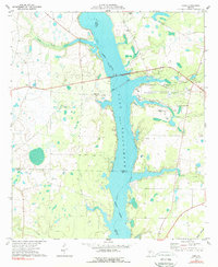
1977 Map of Cobb
USGS Topo · Published 1977About this map
Lake Blackshear dominates this mid-1970s landscape, serving as a focal point for recreation and a natural boundary between Sumter, Crisp, and Lee Counties. The Flint River flows into the reservoir, where the Georgia Veterans Memorial State Park offers developed facilities including a campground and a water tank near the shoreline. The settlement of Cobb is situated to the west, where the Seaboard Coast Line railroad crosses the terrain toward the river.
Find a feature on this map
26 named features on this map. Tap any name to fly to it.
Don’t see what you’re looking for? This feature index may not catch every label — zoom into the map to look around manually.
Map Details
Editions of this 1977 Cobb Map
2 editions found
Other maps of this area

1953 · Dothan
USGS Topo · 1:250,000

1953 · Waycross
USGS Topo · 1:250,000

1954 · Dothan
USGS Topo · 1:250,000

1955 · Dothan
USGS Topo · 1:250,000

1955 · Phenix City
USGS Topo · 1:250,000

1956 · Leslie
USGS Topo · 1:62,500

1957 · Phenix City
USGS Topo · 1:250,000

1957 · Macon
USGS Topo · 1:250,000

1958 · Macon
USGS Topo · 1:250,000

1958 · Phenix City
USGS Topo · 1:250,000