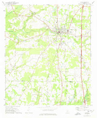
1972 Map of Vienna
USGS Topo · Published 1975About this map
Vienna serves as the regional hub for this agricultural and transport-heavy landscape during the early 1970s. The town is situated at the intersection of two major rail lines, the Seaboard Coast Line and the Southern railroad, which supported the local economy alongside the newly established Interstate 75. The presence of the Dooly Medical Center and a High Sch marks the town's role as a county seat and service center for the surrounding rural communities.
Find a feature on this map
33 named features on this map. Tap any name to fly to it.
Don’t see what you’re looking for? This feature index may not catch every label — zoom into the map to look around manually.
Map Details
Editions of this 1972 Vienna Map
This is the sole edition of this map. No revisions or reprints were ever made.
Other maps of this area

1953 · Waycross
USGS Topo · 1:250,000

1957 · Macon
USGS Topo · 1:250,000

1958 · Macon
USGS Topo · 1:250,000

1958 · Waycross
USGS Topo · 1:250,000

1964 · Macon
USGS Topo · 1:250,000

1971 · Pineview NW
USGS Topo · 1:24,000

1971 · Pineview SW
USGS Topo · 1:24,000

1971 · Pinehurst
USGS Topo · 1:24,000

1972 · Byromville
USGS Topo · 1:24,000

1972 · Drayton
USGS Topo · 1:24,000