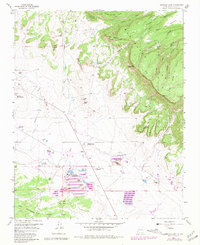
1957 Map of Ambrosia Lake
USGS Topo · Published 1981About this map
Kermac Nuclear Fuels Processing Plant and the Phillips Petroleum Ambrosia Mill anchor the industrial landscape of this uranium-rich region during the late 1950s. The map details an intensive network of extractive operations, including the Homestake-Sapin Mine No 23 and Ann Lee Mine No 1, which supported the Cold War-era nuclear energy boom. These industrial sites are concentrated in the flats near Ambrosia Lake and a localized Trailer Park, while the surrounding terrain rises toward the high elevations of San Mateo Mesa and the Cibola National Forest.
Find a feature on this map
53 named features on this map. Tap any name to fly to it.
Don’t see what you’re looking for? This feature index may not catch every label — zoom into the map to look around manually.
Map Details
Editions of this 1957 Ambrosia Lake Map
Other maps of this area

1883 · Mt. Taylor
USGS Topo · 1:250,000

1886 · Mt. Taylor
USGS Topo · 1:250,000

1892 · Mt. Taylor
USGS Topo · 1:250,000

1899 · Mt. Taylor
USGS Topo · 1:250,000

1957 · Ambrosia Lake
USGS Topo · 1:24,000

1957 · Dos Lomas
USGS Topo · 1:24,000

1957 · Bluewater
USGS Topo · 1:24,000

1957 · Goat Mountain
USGS Topo · 1:24,000

1958 · Albuquerque
USGS Topo · 1:250,000

1961 · Piedra De La Aguila
USGS Topo · 1:24,000