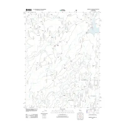
2012 Map of American House
USGS Topo · Published 2012About this map
American House and its eponymous ravine sit at the heart of this landscape, reflecting a long history of settlement and travel through the Sierra foothills. The map reveals a transition from remote ranching at McIntosh Ranch and Boehme Ranch to the industrial legacy of the Sanborn Mine. Water dominates the geography, with the S Fork Feather River and Little Grass Valley Reservoir providing central landmarks, while protected spaces like the Valley Creek Special Interest Area indicate modern conservation efforts. Higher elevations are marked by prominent peaks such as Big Peak and Camel Peak, separated by deep cuts like Big Peak Ravine and Devils Gap. This network of ridges, including Mooreville Ridge and Harrison Ridge, defines the drainage patterns for numerous waterways like Onion Cr and Slate Cr that once supported the region's mining and ranching economy.
Find a feature on this map
42 named features on this map. Tap any name to fly to it.
Don’t see what you’re looking for? This feature index may not catch every label — zoom into the map to look around manually.
Map Details
Editions of this 2012 American House Map
This is the sole edition of this map. No revisions or reprints were ever made.
Other maps of this area

1888 · Bidwell Bar
USGS Topo · 1:125,000

1891 · Bidwell Bar
USGS Topo · 1:125,000

1891 · Downieville
USGS Topo · 1:125,000

1893 · Bidwell Bar
USGS Topo · 1:125,000

1893 · Downieville
USGS Topo · 1:125,000

1895 · Bidwell Bar
USGS Topo · 1:125,000

1895 · Downieville
USGS Topo · 1:125,000

1896 · Downieville
USGS Topo · 1:125,000

1897 · Bidwell Bar
USGS Topo · 1:125,000

1897 · Downieville
USGS Topo · 1:125,000