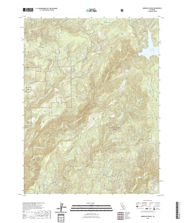
2021 Map of American House
USGS Topo · Published 2021About this map
Plumas National Forest dominates this high-country landscape, where the Sierra Nevada terrain is carved by the South Fork Feather River and its various tributaries. The northern reaches are anchored by the Little Grass Valley Reservoir, a significant water feature that transformed the original Little Grass Valley. Steep ridgelines like Lumpkin Ridge and Mooreville Ridge define the drainage patterns of this area, separating the deeply incised ravines that characterize the local topography.
Find a feature on this map
56 named features on this map. Tap any name to fly to it.
Don’t see what you’re looking for? This feature index may not catch every label — zoom into the map to look around manually.
Map Details
Editions of this 2021 American House Map
This is the sole edition of this map. No revisions or reprints were ever made.
Other maps of this area

1888 · Bidwell Bar
USGS Topo · 1:125,000

1891 · Bidwell Bar
USGS Topo · 1:125,000

1891 · Downieville
USGS Topo · 1:125,000

1893 · Bidwell Bar
USGS Topo · 1:125,000

1893 · Downieville
USGS Topo · 1:125,000

1895 · Bidwell Bar
USGS Topo · 1:125,000

1895 · Downieville
USGS Topo · 1:125,000

1896 · Downieville
USGS Topo · 1:125,000

1897 · Bidwell Bar
USGS Topo · 1:125,000

1897 · Downieville
USGS Topo · 1:125,000