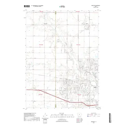
2018 Map of Ames West
USGS Topo · Published 2018About this map
Squaw Creek and its many tributaries, including Onion Cr and Worrell Cr, carve through the landscape west of the city of Ames. This 2018 survey captures the transition from the structured residential blocks of Ontario and the northern outskirts of the university town to the agricultural expanses of the Boone and Story County line. The settlement of Zenorsville sits in the northwest corner, while the town of Gilbert anchors the northeast, connected by a network of county roads like County Highway E26. Local history and genealogy are anchored by several dedicated burial sites, including Gilbert Cem, Ontario Cem, Branch Cem, and the Iowa State University Cemetery, providing a detailed look at the rural and institutional heritage of central Iowa.
Find a feature on this map
129 named features on this map. Tap any name to fly to it.
Don’t see what you’re looking for? This feature index may not catch every label — zoom into the map to look around manually.
Map Details
Editions of this 2018 Ames West Map
This is the sole edition of this map. No revisions or reprints were ever made.
Other maps of this area

1911 · Madrid
USGS Topo · 1:62,500

1911 · Slater
USGS Topo · 1:62,500

1912 · Ames
USGS Topo · 1:62,500

1913 · Slater
USGS Topo · 1:62,500

1914 · Madrid
USGS Topo · 1:62,500

1914 · Ames
USGS Topo · 1:62,500

1916 · Boone
USGS Topo · 1:62,500

1954 · Waterloo
USGS Topo · 1:250,000

1954 · Des Moines
USGS Topo · 1:250,000

1955 · Waterloo
USGS Topo · 1:250,000