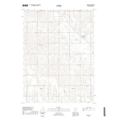
2017 Map of Amherst
USGS Topo · Published 2017About this map
The village of Amherst serves as the central hub of this Buffalo County landscape, where the Wood River cuts a diagonal path through the undulating terrain. A dense network of section-line roads, such as Custer Rd and Odessa Rd, illustrates the highly organized agricultural grid typical of central Nebraska. This 2017 survey captures the modern rural landscape as it balances historical settlement patterns with contemporary infrastructure. Genealogists will find interest in Stanley Cem, located southeast of the village near 145th Rd. The map also documents long-standing transit corridors, including Pole Line Rd and Midway Rd, which reflect the region's historical reliance on established freight and utility routes between scattered prairie farmsteads.
Find a feature on this map
30 named features on this map. Tap any name to fly to it.
Don’t see what you’re looking for? This feature index may not catch every label — zoom into the map to look around manually.
Map Details
Editions of this 2017 Amherst Map
This is the sole edition of this map. No revisions or reprints were ever made.
Other maps of this area

1894 · Kearney
USGS Topo · 1:62,500

1896 · Kearney
USGS Topo · 1:125,000

1955 · Grand Island
USGS Topo · 1:250,000

1957 · Grand Island
USGS Topo · 1:250,000

1958 · Grand Island
USGS Topo · 1:250,000

1961 · Elm Creek West
USGS Topo · 1:24,000

1961 · Amherst
USGS Topo · 1:24,000

1961 · Miller SW
USGS Topo · 1:24,000

1962 · Riverdale
USGS Topo · 1:24,000

1962 · Elm Creek East
USGS Topo · 1:24,000