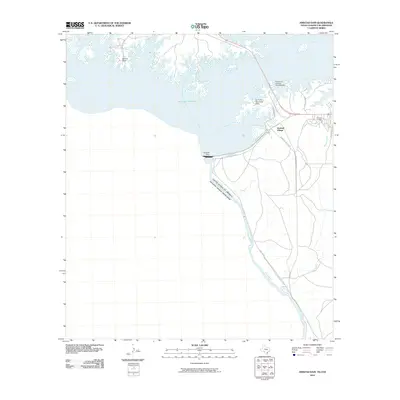
2010 Map of Amistad Dam
USGS Topo · Published 2010About this map
Amistad Dam stands as the central engineering feat of this border landscape, where the waters of the Rio Grande are impounded to form the massive Amistad Reservoir. This international boundary zone between the United States and Mexico showcases a modern recreation and utility network. The map detail highlights lakeside developments such as Amistad Village and Salems Point, alongside public facilities like the Air Force Recreation Area and the Governors Landing Amphitheater. The infrastructure is defined by specialized routes such as State Spur 349 and Vega Verde, which connect the dam site to the surrounding terrain of McKees Creek. The presence of S Winds Marina reflects the mid-to-late 20th-century transformation of this desert river valley into a significant water-management and tourism hub.
Find a feature on this map
19 named features on this map. Tap any name to fly to it.
Don’t see what you’re looking for? This feature index may not catch every label — zoom into the map to look around manually.
Map Details
Editions of this 2010 Amistad Dam Map
This is the sole edition of this map. No revisions or reprints were ever made.
Other maps of this area

1941 · Feely
USGS Topo · 1:62,500

1943 · Devils River
USGS Topo · 1:62,500

1943 · Del Rio
USGS Topo · 1:62,500

1944 · Devils River
USGS Topo · 1:62,500

1944 · Devils Lake
USGS Topo · 1:62,500

1958 · Del Rio
USGS Topo · 1:250,000

1964 · Del Rio
USGS Topo · 1:250,000

1972 · Amistad Dam
USGS Topo · 1:24,000

1972 · California Creek
USGS Topo · 1:24,000

1972 · Del Rio SW
USGS Topo · 1:24,000