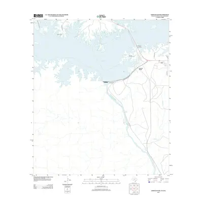
2013 Map of Amistad Dam
USGS Topo · Published 2013About this map
Amistad Dam anchors this international border landscape, where the waters of the Amistad Reservoir meet the winding course of the Rio Grande. This 2013 survey illustrates the developed recreation and residential infrastructure surrounding the reservoir, including Amistad Village and the peninsula at Salems Point. The map provides a clear view of the transition from the controlled waters of the reservoir to the natural drainage of McKee Cr and the emergence of McKee Springs downstream from the dam.
Find a feature on this map
18 named features on this map. Tap any name to fly to it.
Don’t see what you’re looking for? This feature index may not catch every label — zoom into the map to look around manually.
Map Details
Editions of this 2013 Amistad Dam Map
This is the sole edition of this map. No revisions or reprints were ever made.
Other maps of this area

1941 · Feely
USGS Topo · 1:62,500

1943 · Devils River
USGS Topo · 1:62,500

1943 · Del Rio
USGS Topo · 1:62,500

1944 · Devils River
USGS Topo · 1:62,500

1944 · Devils Lake
USGS Topo · 1:62,500

1958 · Del Rio
USGS Topo · 1:250,000

1964 · Del Rio
USGS Topo · 1:250,000

1972 · Amistad Dam
USGS Topo · 1:24,000

1972 · California Creek
USGS Topo · 1:24,000

1972 · Del Rio SW
USGS Topo · 1:24,000