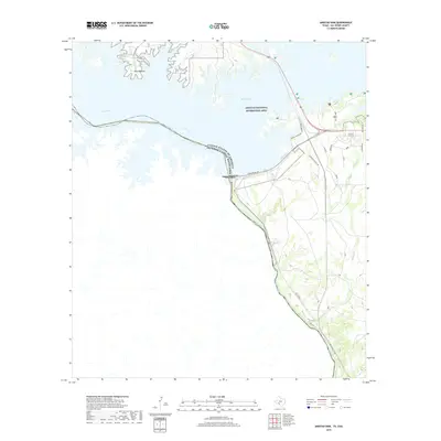
2019 Map of Amistad Dam
USGS Topo · Published 2019About this map
Amistad Dam stands as the central engineering feature of this border landscape, spanning the Rio Grande to divide the United States of America and Estados Unidos Mexicanos. The impounded waters of the Amistad National Recreation Area have transformed the arid terrain into a complex of aquatic features like Walk Lake and inlets near Salems Point. This 2019 survey illustrates the modern intersection of international infrastructure and recreational development, where residential and access roads such as S Amistad Village Rd, Diablo East Rd, and S Winds Marina meet the stark topography of the river basin.
Find a feature on this map
25 named features on this map. Tap any name to fly to it.
Don’t see what you’re looking for? This feature index may not catch every label — zoom into the map to look around manually.
Map Details
Editions of this 2019 Amistad Dam Map
This is the sole edition of this map. No revisions or reprints were ever made.
Other maps of this area

1941 · Feely
USGS Topo · 1:62,500

1943 · Devils River
USGS Topo · 1:62,500

1943 · Del Rio
USGS Topo · 1:62,500

1944 · Devils River
USGS Topo · 1:62,500

1944 · Devils Lake
USGS Topo · 1:62,500

1958 · Del Rio
USGS Topo · 1:250,000

1964 · Del Rio
USGS Topo · 1:250,000

1972 · Amistad Dam
USGS Topo · 1:24,000

1972 · California Creek
USGS Topo · 1:24,000

1972 · Del Rio SW
USGS Topo · 1:24,000