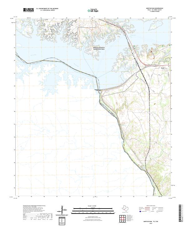
2022 Map of Amistad Dam
USGS Topo · Published 2022About this map
The United States of America Estados Unidos Mexicanos international boundary follows the winding course of the Rio Grande through this section of Val Verde County. Much of the northern terrain is defined by the Amistad National Recreation Area, where the jagged shoreline of the reservoir creates numerous inlets and peninsulas, including Salems Point and its associated Salem Point Rd. This modern survey illustrates the development of recreational access and local infrastructure near the dam, with corridors like United States Highway 90 and the South Winds Marina providing entry to the water. Away from the main lake, the landscape retains its arid character, marked by features such as McKee Springs and the drainage of McKees Cr. The map also captures several residential and access roads, including S Amistad Village Rd and Vega Verde, indicating the extent of settlement along the river valley.
Find a feature on this map
22 named features on this map. Tap any name to fly to it.
Don’t see what you’re looking for? This feature index may not catch every label — zoom into the map to look around manually.
Map Details
Editions of this 2022 Amistad Dam Map
This is the sole edition of this map. No revisions or reprints were ever made.
Other maps of this area

1941 · Feely
USGS Topo · 1:62,500

1943 · Devils River
USGS Topo · 1:62,500

1943 · Del Rio
USGS Topo · 1:62,500

1944 · Devils River
USGS Topo · 1:62,500

1944 · Devils Lake
USGS Topo · 1:62,500

1958 · Del Rio
USGS Topo · 1:250,000

1964 · Del Rio
USGS Topo · 1:250,000

1972 · Amistad Dam
USGS Topo · 1:24,000

1972 · California Creek
USGS Topo · 1:24,000

1972 · Del Rio SW
USGS Topo · 1:24,000