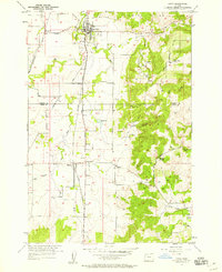
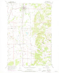
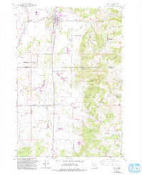
1957 Map of Amity
USGS Topo · Published 1958About this map
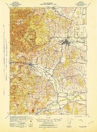
The Southern Pacific railroad corridor dictates the settlement pattern of this mid-century Willamette Valley landscape, connecting the town of Amity with smaller stations and junctions. Agricultural life is centered around fertile lowland reaches like Ash Swale and Salt Creek, while the prominent slopes of the Amity Hills and Eola Hills rise to the east. The map captures a network of rural communities at a stable moment before significant modern expansion, marked by the presence of local landmarks like the High School in Amity and the Bethel Heights Road. Small hamlets such as McCoy, Bethel, and Zena are clearly defined by their namesake cemeteries and churches, serving as vital points of reference for genealogists tracing pioneer families in the area. The division between Yamhill Co and Polk Co runs through the center of the survey, cutting across the rugged terrain of Athey Canyon and the elevated Eola Crest.
Find a feature on this map
27 named features on this map. Tap any name to fly to it.
Don’t see what you’re looking for? This feature index may not catch every label — zoom into the map to look around manually.
Map Details
Editions of this 1957 Amity Map
3 editions found
Other maps of this area

1915 · Rickreall
USGS Topo · 1:31,680

1915 · Eola
USGS Topo · 1:31,680

1917 · Salem
USGS Topo · 1:62,500

1924 · Mc Minnville
USGS Topo · 1:48,000

1926 · Mc Minnville
USGS Topo · 1:62,500

1940 · McMinnville
USGS Topo · 1:62,500
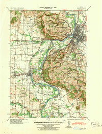
1940 · Salem
USGS Topo · 1:62,500

1942 · Sheridan
USGS Topo · 1:62,500
1942 · Dallas
USGS Topo · 1:62,500

1948 · Vancouver
USGS Topo · 1:250,000