1957 Map of Amity
USGS Topo · Published 1971About this map
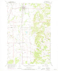
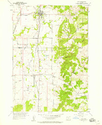
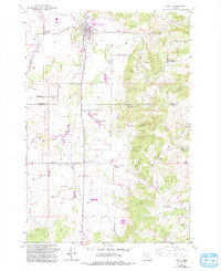
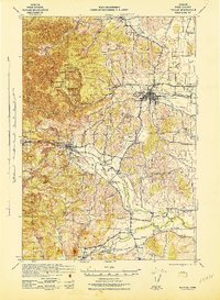
The agricultural heart of the Willamette Valley is centered around Amity on this mid-century survey, which details the interface between the valley floor and the prominent Amity Hills. Transport is defined by the Southern Pacific railroad and Highway 99W, which parallel each other through small hubs like Briedwell, McCoy, and Finns Corner. These small crossings and railway points served as vital collection nodes for local growers during this period.
Find a feature on this map
28 named features on this map. Tap any name to fly to it.
Don’t see what you’re looking for? This feature index may not catch every label — zoom into the map to look around manually.
Map Details
Editions of this 1957 Amity Map
3 editions found
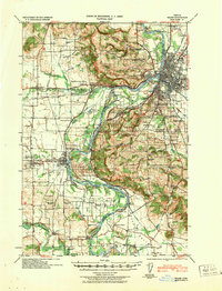
Other maps of this area

1915 · Rickreall
USGS Topo · 1:31,680

1915 · Eola
USGS Topo · 1:31,680

1917 · Salem
USGS Topo · 1:62,500

1924 · Mc Minnville
USGS Topo · 1:48,000

1926 · Mc Minnville
USGS Topo · 1:62,500

1940 · McMinnville
USGS Topo · 1:62,500
1940 · Salem
USGS Topo · 1:62,500

1942 · Sheridan
USGS Topo · 1:62,500
1942 · Dallas
USGS Topo · 1:62,500

1948 · Vancouver
USGS Topo · 1:250,000