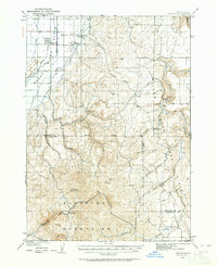
1924 Map of Ammon
USGS Topo · Published 1964About this map
The Snake River plain meets the rising peaks of the Blackfoot Mountains in this early 20th-century topographic record. Centered on the growing agricultural settlement of Ammon, the map traces the intricate water management systems essential to the region's development, including the Hillside Canal and Union Canal. The landscape transitions from the flatlands served by the Pacific railroad to the complex drainage of the mountains, dominated by Mt Taylor (Blackfoot Pk).
Find a feature on this map
35 named features on this map. Tap any name to fly to it.
Don’t see what you’re looking for? This feature index may not catch every label — zoom into the map to look around manually.
Map Details
Editions of this 1924 Ammon Map
3 editions found
Other maps of this area

1917 · Cranes Flat
USGS Topo · 1:62,500

1918 · Paradise Valley
USGS Topo · 1:62,500

1924 · Hell Creek
USGS Topo · 1:62,500

1924 · Ammon
USGS Topo · 1:62,500

1926 · Hell Creek
USGS Topo · 1:62,500

1948 · Idaho Falls North
USGS Topo · 1:24,000

1948 · Idaho Falls South
USGS Topo · 1:24,000

1948 · Ucon
USGS Topo · 1:24,000

1949 · Ucon
USGS Topo · 1:24,000

1949 · Idaho Falls North
USGS Topo · 1:24,000