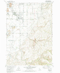
1981 Map of Ammon
USGS Topo · Published 1985About this map
Ammon and the eastern outskirts of Idaho Falls are depicted during a period of residential and educational growth in the early 1980s. The map illustrates the suburban expansion eastward from the Union Pacific Railroad toward the rising elevations of the Sand Hills. Significant local institutions are documented, including the Eastern Idaho Vocational Technical School and Falls Valley Sch, alongside community landmarks such as the Iona Cemetery and Ammon Cemetery.
Find a feature on this map
36 named features on this map. Tap any name to fly to it.
Don’t see what you’re looking for? This feature index may not catch every label — zoom into the map to look around manually.
Map Details
Editions of this 1981 Ammon Map
3 editions found
Other maps of this area

1924 · Ammon
USGS Topo · 1:62,500

1948 · Idaho Falls North
USGS Topo · 1:24,000

1948 · Idaho Falls South
USGS Topo · 1:24,000

1948 · Ucon
USGS Topo · 1:24,000

1949 · Ucon
USGS Topo · 1:24,000

1949 · Idaho Falls North
USGS Topo · 1:24,000

1949 · Roberts
USGS Topo · 1:62,500

1950 · Idaho Falls South
USGS Topo · 1:24,000

1950 · Rigby
USGS Topo · 1:62,500

1950 · Goshen
USGS Topo · 1:24,000