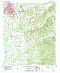
1992 Map of Amory
USGS Topo · Published 1995About this map
The railroad town of Amory serves as the focal point of this Mississippi landscape, defined by a grid of streets and the industrial presence of the Roundhouse. To the east, the terrain transitions into the creek valleys of Burketts Creek and Weaver Creek, where the settlement of Hatley is situated. The map illustrates a rural social fabric maintained through numerous country churches and burial grounds, such as St Matthews Ch and Harmony Ch Cem.
Find a feature on this map
35 named features on this map. Tap any name to fly to it.
Don’t see what you’re looking for? This feature index may not catch every label — zoom into the map to look around manually.
Map Details
Editions of this 1992 Amory Map
This is the sole edition of this map. No revisions or reprints were ever made.
Other maps of this area

1953 · West Point
USGS Topo · 1:250,000

1956 · Tupelo
USGS Topo · 1:250,000

1958 · Tupelo
USGS Topo · 1:250,000

1958 · West Point
USGS Topo · 1:250,000

1963 · West Point
USGS Topo · 1:250,000

1966 · Smithville
USGS Topo · 1:24,000

1966 · Aberdeen
USGS Topo · 1:24,000

1966 · Amory
USGS Topo · 1:24,000

1966 · Amory SW
USGS Topo · 1:24,000

1966 · Turon
USGS Topo · 1:24,000