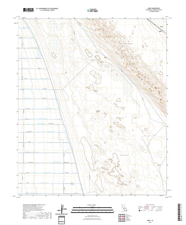
2021 Map of Amos
USGS Topo · Published 2021About this map
The Imperial Valley meets the eastern desert landscape in this detailed topographic record, centered on the settlement of Amos. This area is defined by the sharp transition between the irrigated agricultural lands of the west and the arid reaches of the Algodones Dunes to the east. A dense network of man-made waterways, including the East Highline Canal, the Vail Supply Canal, and numerous lateral drains like the Mulberry Drain and Myrtle Drain, illustrates the complex engineering required to sustain desert farming.
Find a feature on this map
67 named features on this map. Tap any name to fly to it.
Don’t see what you’re looking for? This feature index may not catch every label — zoom into the map to look around manually.
Map Details
Editions of this 2021 Amos Map
This is the sole edition of this map. No revisions or reprints were ever made.
Other maps of this area

1907 · Holtville
USGS Topo · 1:125,000

1940 · Iris
USGS Topo · 1:62,500

1940 · Alamorio
USGS Topo · 1:62,500

1942 · El Centro
USGS Topo · 1:250,000

1945 · Alamorio
USGS Topo · 1:62,500

1945 · Iris
USGS Topo · 1:62,500

1953 · Acolita
USGS Topo · 1:24,000

1953 · Acolita
USGS Topo · 1:62,500

1954 · El Centro
USGS Topo · 1:250,000

1954 · Salton Sea
USGS Topo · 1:250,000