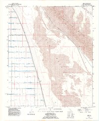
1992 Map of Amos
USGS Topo · Published 1995About this map
Amos sits at the desert crossroads of the Southern Pacific railroad and the Niland Glamis Road, serving as a small outpost in the arid landscape of eastern Imperial County. This 1992 revision, based on earlier mid-century imagery, illustrates a sharp environmental divide. To the east, the shifting sands of the Algodones Dunes create a vast natural barrier, while the East Mesa to the west is dominated by a complex, grid-like irrigation network.
Find a feature on this map
51 named features on this map. Tap any name to fly to it.
Don’t see what you’re looking for? This feature index may not catch every label — zoom into the map to look around manually.
Map Details
Editions of this 1992 Amos Map
This is the sole edition of this map. No revisions or reprints were ever made.
Other maps of this area

1907 · Holtville
USGS Topo · 1:125,000

1940 · Iris
USGS Topo · 1:62,500

1940 · Alamorio
USGS Topo · 1:62,500

1942 · El Centro
USGS Topo · 1:250,000

1945 · Alamorio
USGS Topo · 1:62,500

1945 · Iris
USGS Topo · 1:62,500

1953 · Acolita
USGS Topo · 1:24,000

1953 · Acolita
USGS Topo · 1:62,500

1954 · El Centro
USGS Topo · 1:250,000

1954 · Salton Sea
USGS Topo · 1:250,000