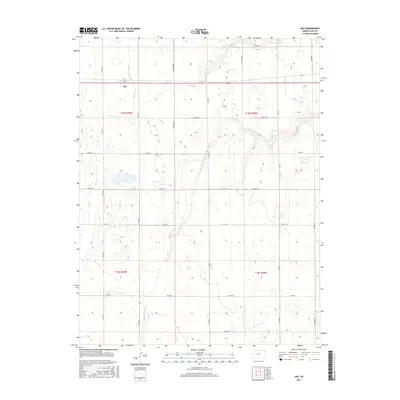
2015 Map of Amy
USGS Topo · Published 2015About this map
The small unincorporated community of Amy is the primary settlement in this high plains landscape of western Kansas, situated along the corridor of State Highway 96. The terrain is defined by the ephemeral drainage of S Fork Walnut Cr, which winds through a series of sections including t18s r30w, t18s r29w, t19s r30w, and t19s r29w. The map reveals a strictly organized rural infrastructure, where the Jeffersonian grid system dictates the placement of gravel and dirt thoroughfares such as Eagle Rd, Gage Rd, and Jagger Rd. This layout illustrates the intersection of modern transportation and early 20th-century land division, where small clusters of ranch and farm buildings are dispersed across a landscape dominated by agricultural production and natural drainage patterns.
Find a feature on this map
21 named features on this map. Tap any name to fly to it.
Don’t see what you’re looking for? This feature index may not catch every label — zoom into the map to look around manually.
Map Details
Editions of this 2015 Amy Map
This is the sole edition of this map. No revisions or reprints were ever made.
Other maps of this area

1955 · Scott City
USGS Topo · 1:250,000

1958 · Scott City
USGS Topo · 1:250,000

1974 · Dighton SW
USGS Topo · 1:24,000

1974 · Amy SE
USGS Topo · 1:24,000

1974 · Dighton
USGS Topo · 1:24,000

1974 · Amy SW
USGS Topo · 1:24,000

1974 · Grigston
USGS Topo · 1:24,000

1974 · Amy
USGS Topo · 1:24,000

1974 · Manning
USGS Topo · 1:24,000

1974 · Healy
USGS Topo · 1:24,000