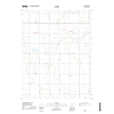
2018 Map of Amy
USGS Topo · Published 2018About this map
Amy occupies a central position in this high plains landscape of Lane County, where the agricultural grid meets the natural winding course of the S Fork Walnut Cr. The terrain is defined by the strict geometry of the Public Land Survey System, with township lines like t18s r30w and t18s r29w partitioning the dry creek beds and seasonal wetlands. This 2018 survey illustrates a modern rural infrastructure dependent on an extensive network of section-line roads, including Eagle Rd, Gage Rd, and Ike Rd. The drainage patterns of the S Fork Walnut Cr provide the primary relief in an otherwise level landscape, carving subtle paths through the sections south of the settlement. For researchers, the map serves as a clear record of contemporary land use, documenting the precise location of farmsteads and rural routes that have sustained this part of Western Kansas for generations.
Find a feature on this map
20 named features on this map. Tap any name to fly to it.
Don’t see what you’re looking for? This feature index may not catch every label — zoom into the map to look around manually.
Map Details
Editions of this 2018 Amy Map
This is the sole edition of this map. No revisions or reprints were ever made.
Other maps of this area

1955 · Scott City
USGS Topo · 1:250,000

1958 · Scott City
USGS Topo · 1:250,000

1974 · Dighton SW
USGS Topo · 1:24,000

1974 · Amy SE
USGS Topo · 1:24,000

1974 · Dighton
USGS Topo · 1:24,000

1974 · Amy SW
USGS Topo · 1:24,000

1974 · Grigston
USGS Topo · 1:24,000

1974 · Amy
USGS Topo · 1:24,000

1974 · Manning
USGS Topo · 1:24,000

1974 · Healy
USGS Topo · 1:24,000