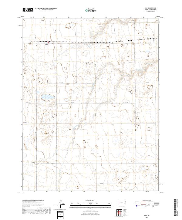
2022 Map of Amy
USGS Topo · Published 2022About this map
Amy stands as the primary point of settlement in this expansive section of the High Plains, positioned near the intersection of Eagle Rd and the northern border of Lane County. The landscape is defined by the winding course of the S Fork Walnut Cr, which carves a subtle valley through the agricultural grid. This 2022 survey illustrates a classic Western Kansas township-and-range layout, where local transport depends on a structured network of named corridors like Frontier Rd, Hickock Rd, and Gage Rd. The distribution of scattered wetlands and the drainage pattern of the creek suggest the importance of seasonal water management in this semi-arid region. For those tracing the evolution of Lane County land use, the map provides a clear record of modern property divisions and rural infrastructure within t18s r30w and t18s r29w.
Find a feature on this map
20 named features on this map. Tap any name to fly to it.
Don’t see what you’re looking for? This feature index may not catch every label — zoom into the map to look around manually.
Map Details
Editions of this 2022 Amy Map
This is the sole edition of this map. No revisions or reprints were ever made.
Other maps of this area

1955 · Scott City
USGS Topo · 1:250,000

1958 · Scott City
USGS Topo · 1:250,000

1974 · Dighton SW
USGS Topo · 1:24,000

1974 · Amy SE
USGS Topo · 1:24,000

1974 · Dighton
USGS Topo · 1:24,000

1974 · Amy SW
USGS Topo · 1:24,000

1974 · Grigston
USGS Topo · 1:24,000

1974 · Amy
USGS Topo · 1:24,000

1974 · Manning
USGS Topo · 1:24,000

1974 · Healy
USGS Topo · 1:24,000