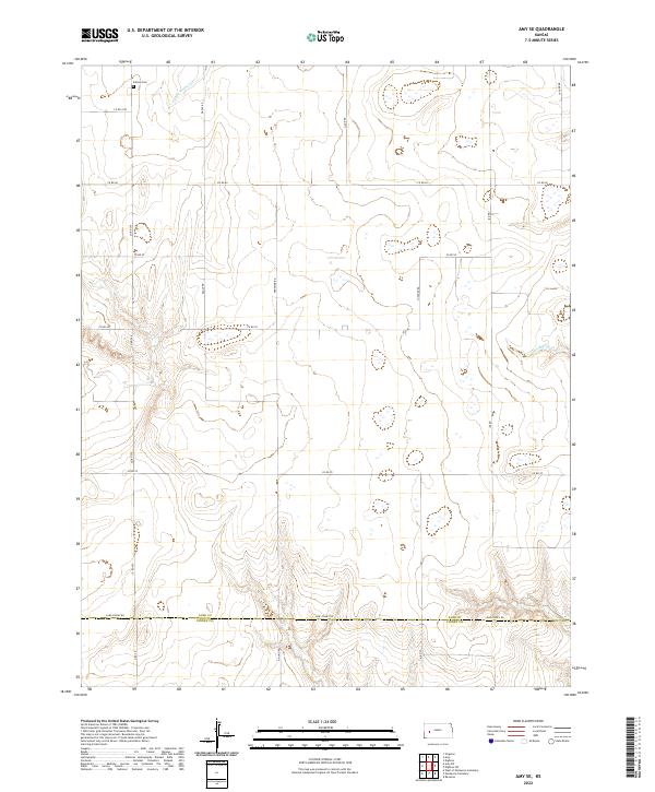
2022 Map of Amy SE
USGS Topo · Published 2022About this map
The border of Lane Co Finney Co defines the southern portion of this High Plains landscape, where the agricultural grid meets the natural drainage of the S Fork Walnut Cr. This 2022 survey captures a rural territory characterized by expansive section lines and seasonal watercourses. For family historians and genealogists, the presence of the Sutton Cem in the northwest corner near Co Rd 1074 provides a specific point of interest in an otherwise sparsely populated region. The terrain is lightly dissected by Hackberry Cr in the east, while a network of named section roads like Eagle Rd, Frontier Rd, and Jagger Rd organizes the prairie into distinct townships. The map illustrates the persistent structure of Kansas land divisions, where the intersection of county lines and local access roads like Lane-Finney Rd continues to shape the region's movement and land use.
Find a feature on this map
26 named features on this map. Tap any name to fly to it.
Don’t see what you’re looking for? This feature index may not catch every label — zoom into the map to look around manually.
Map Details
Editions of this 2022 Amy SE Map
This is the sole edition of this map. No revisions or reprints were ever made.
Other maps of this area

1955 · Scott City
USGS Topo · 1:250,000

1958 · Scott City
USGS Topo · 1:250,000

1974 · Ravanna
USGS Topo · 1:24,000
1974 · Scott City 4 NW
USGS Topo · 1:24,000

1974 · Dighton SW
USGS Topo · 1:24,000

1974 · Amy SE
USGS Topo · 1:24,000

1974 · Dighton
USGS Topo · 1:24,000

1974 · Scott City 4 NE
USGS Topo · 1:24,000

1974 · Amy SW
USGS Topo · 1:24,000

1974 · Grigston
USGS Topo · 1:24,000