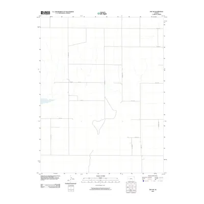
2009 Map of Amy SW
USGS Topo · Published 2009About this map
Dry Lake anchors the western edge of this High Plains landscape in Finney County, illustrating the ephemeral hydrology of the Kansas prairie. The map captures a strictly gridded agricultural sectioning defined by an extensive network of rural corridors, including S Venison Rd, Lane Scott, and Arapahoe Rd. These routes follow the precise north-south and east-west section lines characteristic of the public land survey system, facilitating the movement of machinery and crops through the expansive fields. Small drainages cut through the center of the quadrangle, where the terrain breaks slightly from the flat upland to feed toward the basin of the lake. The names of the roads, such as Cheyenne Rd and Abilene Rd, reflect the cattle-trail and tribal history woven into the geography of the Great Plains, even as the landscape remains primarily dedicated to modern ranching and farming operations.
Find a feature on this map
16 named features on this map. Tap any name to fly to it.
Don’t see what you’re looking for? This feature index may not catch every label — zoom into the map to look around manually.
Map Details
Editions of this 2009 Amy SW Map
This is the sole edition of this map. No revisions or reprints were ever made.
Other maps of this area

1940 · Scott City
USGS Topo · 1:62,500

1944 · Tennis
USGS Topo · 1:62,500

1951 · Scott City
USGS Topo · 1:62,500

1955 · Scott City
USGS Topo · 1:250,000

1958 · Scott City
USGS Topo · 1:250,000
1974 · Scott City 4 NW
USGS Topo · 1:24,000

1974 · Amy SE
USGS Topo · 1:24,000

1974 · Scott City 4 NE
USGS Topo · 1:24,000

1974 · Amy SW
USGS Topo · 1:24,000

1974 · Grigston
USGS Topo · 1:24,000