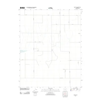
2012 Map of Amy SW
USGS Topo · Published 2012About this map
Dry Lake sits as a prominent geographic feature in this corner of Finney County, illustrating the arid hydrography characteristic of western Kansas. This 2012 survey by the U.S. Geological Survey documents a landscape defined by an exceptionally rigid section-line grid system, where travel is dictated by long, straight thoroughfares such as S Venison Rd and Arapahoe Rd. The nomenclature of the road network reflects both regional geography and historical influences, with names like Abilene Rd, Cheyenne, and N Mennonite Rd marking the surveyed boundaries. The area around Lane-Scott and the intersection of E Finney Scott Rd demonstrates the large-scale agricultural partitioning typical of the High Plains in the early 21st century.
Find a feature on this map
19 named features on this map. Tap any name to fly to it.
Don’t see what you’re looking for? This feature index may not catch every label — zoom into the map to look around manually.
Map Details
Editions of this 2012 Amy SW Map
This is the sole edition of this map. No revisions or reprints were ever made.
Other maps of this area

1940 · Scott City
USGS Topo · 1:62,500

1944 · Tennis
USGS Topo · 1:62,500

1951 · Scott City
USGS Topo · 1:62,500

1955 · Scott City
USGS Topo · 1:250,000

1958 · Scott City
USGS Topo · 1:250,000
1974 · Scott City 4 NW
USGS Topo · 1:24,000

1974 · Amy SE
USGS Topo · 1:24,000

1974 · Scott City 4 NE
USGS Topo · 1:24,000

1974 · Amy SW
USGS Topo · 1:24,000

1974 · Grigston
USGS Topo · 1:24,000