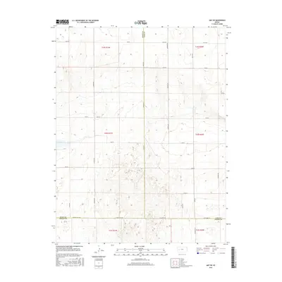
2015 Map of Amy SW
USGS Topo · Published 2015About this map
Dry Lake sits at the heart of this landscape where the high plains of western Kansas meet the intersecting borders of Finney, Scott, and Lane Counties. This 2015 survey reveals a terrain defined by a strict section-line grid of rural roads, including S Venison Rd and Arapahoe Rd, which service a patchwork of agricultural land. The transition between Scott and Lane counties is marked by thoroughfares such as Lane-Finney Rd and E Finney Scott Rd. The map provides an essential record of the local infrastructure for researchers interested in the modern rural economy of the Great Plains, illustrating how the historical Public Land Survey System continues to dictate the movement of goods and people across the plains via long-standing routes like Bison Rd and Abilene Rd.
Find a feature on this map
31 named features on this map. Tap any name to fly to it.
Don’t see what you’re looking for? This feature index may not catch every label — zoom into the map to look around manually.
Map Details
Editions of this 2015 Amy SW Map
This is the sole edition of this map. No revisions or reprints were ever made.
Other maps of this area

1940 · Scott City
USGS Topo · 1:62,500

1944 · Tennis
USGS Topo · 1:62,500

1951 · Scott City
USGS Topo · 1:62,500

1955 · Scott City
USGS Topo · 1:250,000

1958 · Scott City
USGS Topo · 1:250,000
1974 · Scott City 4 NW
USGS Topo · 1:24,000

1974 · Amy SE
USGS Topo · 1:24,000

1974 · Scott City 4 NE
USGS Topo · 1:24,000

1974 · Amy SW
USGS Topo · 1:24,000

1974 · Grigston
USGS Topo · 1:24,000