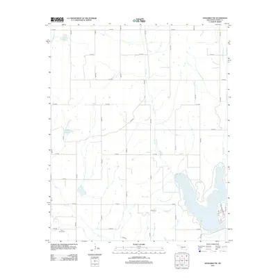
2012 Map of Anadarko NW
USGS Topo · Published 2012About this map
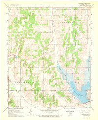
Rock Springs Cem sits in the southwestern corner of this Caddo County landscape, marking a point of long-standing local heritage. The area is defined by the complex drainage of Sugar Cr and its various tributaries, including White Bread Cr, Camp Cr, and Spring Cr. This network of waterways has been modified for water management, as evidenced by the Sugar Cr Site 33 Reservoir and Sugar Cr Site 36 Reservoir. In the east, Lake Chickasha serves as a significant geographic anchor, with the residential layout of Lake View Dr and Lake Chickasha Dr tracing its western shoreline. The map reveals a highly structured rural grid of section line roads, from E 1220 RD to E 1300 RD, which dictate the movement across this agricultural and utility-focused terrain, including access roads like S Lease Rd.
Find a feature on this map
29 named features on this map. Tap any name to fly to it.
Don’t see what you’re looking for? This feature index may not catch every label — zoom into the map to look around manually.
Map Details
Editions of this 2012 Anadarko NW Map
This is the sole edition of this map. No revisions or reprints were ever made.
Other maps of this area

1893 · Buggy Creek
USGS Topo · 1:62,500

1945 · Anadarko
USGS Topo · 1:62,500

1951 · Binger
USGS Topo · 1:62,500

1951 · Fort Cobb
USGS Topo · 1:62,500

1955 · Clinton
USGS Topo · 1:250,000

1957 · Clinton
USGS Topo · 1:250,000
1967 · Cogar
USGS Topo · 1:24,000
1968 · Cogar SE
USGS Topo · 1:24,000
1968 · Anadarko NE
USGS Topo · 1:24,000
1968 · Anadarko NW
USGS Topo · 1:24,000