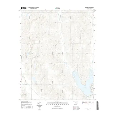
2016 Map of Anadarko NW
USGS Topo · Published 2016About this map
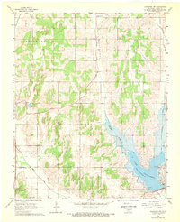
Lake Chickasha dominates the southeastern corner of this Caddo County landscape, its irregular shoreline reaching north from the lower boundary. The terrain is characterized by a dense network of water management sites, including Sugar Cr Site 33 Reservoir, Sugar Cr Site 36 Reservoir, and the Sugar Creek Site 40 Reservoir. These features, alongside named drainages such as Spring Creek and Stinking Creek, illustrate the modern hydrological engineering essential to this part of Oklahoma. In the southwest, Rock Springs Cem serves as a grounded point of local history near the path of Camp Creek. The map details a precise grid of rural routes like Gracemont Rd and various numbered county roads that provide access to the dispersed homesteads and agricultural tracts across the undulating plains.
Find a feature on this map
47 named features on this map. Tap any name to fly to it.
Don’t see what you’re looking for? This feature index may not catch every label — zoom into the map to look around manually.
Map Details
Editions of this 2016 Anadarko NW Map
This is the sole edition of this map. No revisions or reprints were ever made.
Other maps of this area

1893 · Buggy Creek
USGS Topo · 1:62,500

1945 · Anadarko
USGS Topo · 1:62,500

1951 · Binger
USGS Topo · 1:62,500

1951 · Fort Cobb
USGS Topo · 1:62,500

1955 · Clinton
USGS Topo · 1:250,000

1957 · Clinton
USGS Topo · 1:250,000
1967 · Cogar
USGS Topo · 1:24,000
1968 · Cogar SE
USGS Topo · 1:24,000
1968 · Anadarko NE
USGS Topo · 1:24,000
1968 · Anadarko NW
USGS Topo · 1:24,000