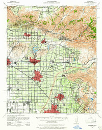
1942 Map of Anaheim
USGS Topo · Published 1961About this map
The Santa Ana River cuts a wide swath across this landscape, separating the growing urban centers of Anaheim and Santa Ana from the rugged canyons to the northeast. During the early 1940s, the region was a patchwork of expanding grid-patterned towns and vast agricultural tracts, interconnected by an extensive rail network including the Pacific Electric, Union Pacific, and Southern Pacific. The presence of the Los Angeles Air Base and small worker settlements like Colonia Manzanillo reflect the wartime industrial and social character of the county.
Find a feature on this map
74 named features on this map. Tap any name to fly to it.
Don’t see what you’re looking for? This feature index may not catch every label — zoom into the map to look around manually.
Map Details
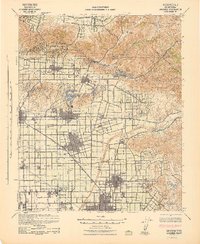
Editions of this 1942 Anaheim Map
2 editions found
Other maps of this area

1894 · Los Angeles
USGS Topo · 1:62,500

1894 · Pomona
USGS Topo · 1:62,500

1896 · Santa Ana
USGS Topo · 1:62,500

1896 · Pasadena
USGS Topo · 1:62,500

1896 · Anaheim
USGS Topo · 1:62,500

1896 · Las Bolsas
USGS Topo · 1:62,500

1896 · Downey
USGS Topo · 1:62,500

1897 · Pomona
USGS Topo · 1:62,500

1897 · Cucamonga
USGS Topo · 1:62,500

1898 · Pomona
USGS Topo · 1:62,500