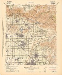
1942 Map of Anaheim
USGS Topo · Published 1942About this map
Anaheim and Fullerton serve as the bustling centers of this 1940s Orange County landscape, where the emerging suburban grid meets established citrus groves and oil fields. The Santa Ana River cuts through the territory, flanked by a dense network of major rail lines including the Union Pacific, Southern Pacific, and Pacific Electric. To the north, the Puente Hills provide a sharp contrast to the flat valley floor, containing the Diamond Bar Ranch and specialized sites like Brea Hot Springs.
Find a feature on this map
77 named features on this map. Tap any name to fly to it.
Don’t see what you’re looking for? This feature index may not catch every label — zoom into the map to look around manually.
Map Details
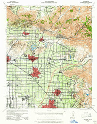
Editions of this 1942 Anaheim Map
2 editions found
Other maps of this area

1894 · Los Angeles
USGS Topo · 1:62,500

1894 · Pomona
USGS Topo · 1:62,500

1896 · Santa Ana
USGS Topo · 1:62,500

1896 · Pasadena
USGS Topo · 1:62,500

1896 · Anaheim
USGS Topo · 1:62,500

1896 · Las Bolsas
USGS Topo · 1:62,500

1896 · Downey
USGS Topo · 1:62,500

1897 · Pomona
USGS Topo · 1:62,500

1897 · Cucamonga
USGS Topo · 1:62,500

1898 · Pomona
USGS Topo · 1:62,500