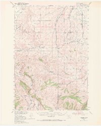
1949 Map of Anceney
USGS Topo · Published 1971About this map
Anceney sits at the heart of this post-war landscape, where the agricultural plains of the Madison Plateau meet the rising foothills of Ruby Mountain and Finnegan Ridge. The settlement pattern is defined by established family holdings like the Sloan Ranch, Butler Ranch, and Home Ranch, reflecting a ranching economy supported by an intricate network of irrigation including the Lowline Canal, Upper Cherry Creek Ditch, and Butler Ditch. Transportation and industry are anchored by the Northern Pacific railroad line and the historic Virginia City Road, which provided vital connections for the region's mineral and livestock interests.
Find a feature on this map
64 named features on this map. Tap any name to fly to it.
Don’t see what you’re looking for? This feature index may not catch every label — zoom into the map to look around manually.
Map Details
Editions of this 1949 Anceney Map
4 editions found
Other maps of this area

1888 · Three Forks
USGS Topo · 1:250,000

1894 · Three Forks
USGS Topo · 1:250,000

1895 · Three Forks
USGS Topo · 1:250,000

1947 · Bozeman
USGS Topo · 1:250,000

1948 · Bozeman
USGS Topo · 1:250,000

1949 · Anceney
USGS Topo · 1:62,500

1949 · Manhattan
USGS Topo · 1:62,500

1949 · Ennis
USGS Topo · 1:62,500

1949 · Norris
USGS Topo · 1:62,500

1950 · Three Forks
USGS Topo · 1:62,500