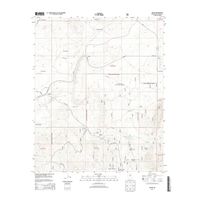
2013 Map of Ancho
USGS Topo · Published 2013About this map
The high-desert terrain of the Ancho Valley is the focal point of this 2013 survey, where the small community of Ancho sits as a lonely rail and road junction against the backdrop of the Jicarilla Mountains. This landscape is defined by its deep connectivity to ranching history, evidenced by the presence of the Hightower Ranch, Wilson Ranch, and Miller Ranch. Drainage patterns like Ancho Gulch and Rico Gulch carve through the foothills of the Lincoln National Forest, which covers much of the eastern and southern portions of the quadrangle. For genealogists, the Ancho Cem and the settlement at Luna provide specific points of interest. The network of unimproved roads, such as Ancho White Oaks and Coyote Canyon Road, reveals how the area’s remote outposts remained accessible in the early 21st century.
Find a feature on this map
42 named features on this map. Tap any name to fly to it.
Don’t see what you’re looking for? This feature index may not catch every label — zoom into the map to look around manually.
Map Details
Editions of this 2013 Ancho Map
This is the sole edition of this map. No revisions or reprints were ever made.
Other maps of this area

1950 · Little Black Peak
USGS Topo · 1:62,500

1954 · Fort Sumner
USGS Topo · 1:250,000

1955 · Roswell
USGS Topo · 1:250,000

1958 · Fort Sumner
USGS Topo · 1:250,000

1958 · Roswell
USGS Topo · 1:250,000

1962 · Roswell
USGS Topo · 1:250,000

1973 · Ancho
USGS Topo · 1:24,000

1973 · Chupadero Mountain
USGS Topo · 1:24,000
1973 · White Oaks North
USGS Topo · 1:24,000

1973 · Jicarilla Peak
USGS Topo · 1:24,000