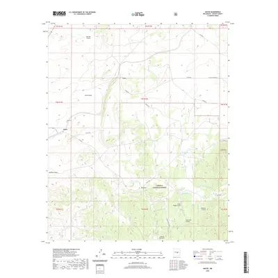
2020 Map of Ancho
USGS Topo · Published 2020About this map
Ancho Valley provides the central corridor for this Lincoln County landscape, where the high desert terrain transitions into the rugged northern reaches of the Lincoln National Forest. The small settlement of Ancho is the primary landmark, serving as a focal point for researchers interested in the rural development of this region. Just north of the town site lies the Ancho Cem, a critical site for genealogists tracing the local families who settled this arid valley.
Find a feature on this map
37 named features on this map. Tap any name to fly to it.
Don’t see what you’re looking for? This feature index may not catch every label — zoom into the map to look around manually.
Map Details
Editions of this 2020 Ancho Map
This is the sole edition of this map. No revisions or reprints were ever made.
Other maps of this area

1950 · Little Black Peak
USGS Topo · 1:62,500

1954 · Fort Sumner
USGS Topo · 1:250,000

1955 · Roswell
USGS Topo · 1:250,000

1958 · Fort Sumner
USGS Topo · 1:250,000

1958 · Roswell
USGS Topo · 1:250,000

1962 · Roswell
USGS Topo · 1:250,000

1973 · Ancho
USGS Topo · 1:24,000

1973 · Chupadero Mountain
USGS Topo · 1:24,000
1973 · White Oaks North
USGS Topo · 1:24,000

1973 · Jicarilla Peak
USGS Topo · 1:24,000