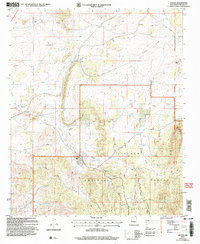
2004 Map of Ancho
USGS Topo · Published 2006About this map
Lincoln National Forest dominates the southern landscape of this high-desert region, where the Jicarilla Mountains rise above the arid plains. The area’s history of ranching and resource extraction is evident in the cluster of mines and private holdings, including the Jicarilla Mine and scattered sites labeled simply as mines or gravel pits. Water management is the primary driver of settlement patterns here, as seen by the numerous scattered water sources like Sinks Tank, Northwest Tank, and West Tank that sustain the local livestock industry.
Find a feature on this map
32 named features on this map. Tap any name to fly to it.
Don’t see what you’re looking for? This feature index may not catch every label — zoom into the map to look around manually.
Map Details
Editions of this 2004 Ancho Map
This is the sole edition of this map. No revisions or reprints were ever made.
Other maps of this area

1950 · Little Black Peak
USGS Topo · 1:62,500

1954 · Fort Sumner
USGS Topo · 1:250,000

1955 · Roswell
USGS Topo · 1:250,000

1958 · Fort Sumner
USGS Topo · 1:250,000

1958 · Roswell
USGS Topo · 1:250,000

1962 · Roswell
USGS Topo · 1:250,000

1973 · Ancho
USGS Topo · 1:24,000

1973 · Chupadero Mountain
USGS Topo · 1:24,000
1973 · White Oaks North
USGS Topo · 1:24,000

1973 · Jicarilla Peak
USGS Topo · 1:24,000